
Affiliate disclosure: As an Amazon Associate I earn from qualifying purchases. Learn more
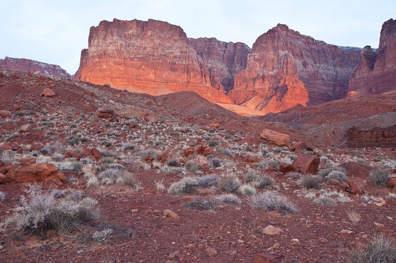
Utah gets a lot of credit for red rock, but some of the wildest sandstone in the Southwest sits right here in northern Arizona. Cliffs climb as much as 3,000 feet above their bases, slot canyons twist through the rock, and swirling formations look like frozen waves.
Many travelers drive past without knowing how much is hiding behind those red walls. Keep reading to learn where this place is, which trails and rock formations deserve your time, and what you need to know before you go, from permits to four-wheel-drive roads.
A Red Rock Monument on Arizona’s Northern Edge
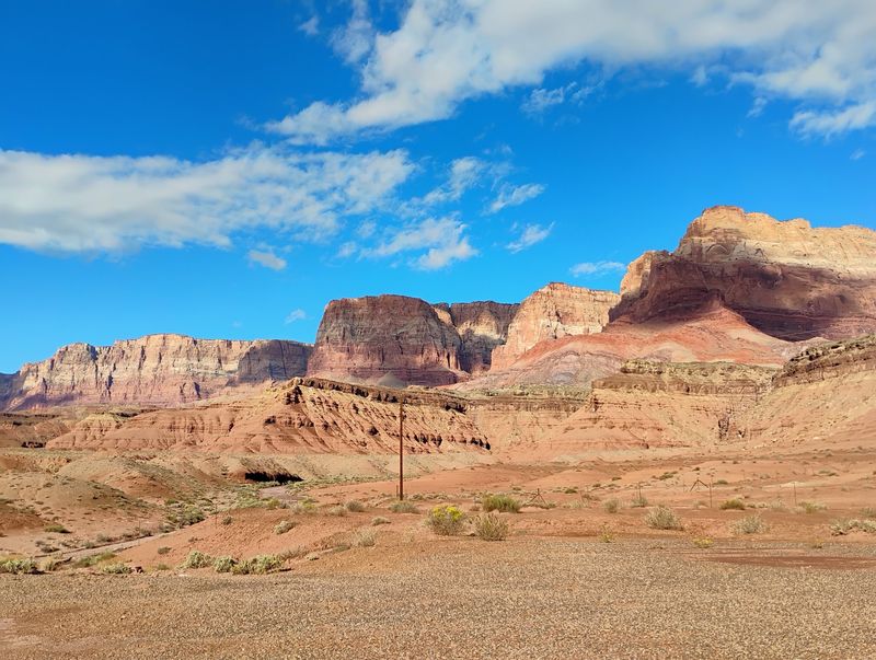
Tucked into the far north of the state, Vermilion Cliffs National Monument sits near Marble Canyon, AZ 86036, in the United States. It is a national reserve managed by the Bureau of Land Management, and it is open 24 hours a day, every day of the week.
The monument is known for its spectacular natural rock formations. Layers of red rock show clear stripes, called stratifications, that stack up like pages in a giant book.
Many people first meet the cliffs from the window of a car on Route 89A. The road runs past miles of towering walls, with a few pull-off spots for photos.
Here is the catch that surprises some first-timers. The spot marked on many map apps is simply a view of the cliff wall.
The famous tunnels, slot canyons, and swirling sandstone sit deeper inside the monument. Reaching them often means rough roads, a high-clearance vehicle, and some planning.
That mix of easy roadside views and hard-won backcountry treasures is what makes this corner of Arizona so special. Think of the highway as the opening act, with the real show waiting down the dirt roads.
Millions of Years Written in Stone
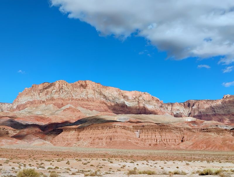
Geology fans, get ready for a long history lesson with a great view. The Vermilion Cliffs are steep, eroded escarpments made mostly of sandstone, siltstone, limestone, and shale.
These cliffs rise as much as 3,000 feet above their bases. That is taller than many skyscrapers stacked on top of each other.
For millions of years, wind and water have worn these sedimentary rocks down. The erosion has exposed hundreds of layers of richly colored rock.
Each band tells part of the story of how this land formed. Some layers are deep red, while others lean toward orange, pink, or pale cream.
Between the cliffs, the landscape keeps changing. Mesas, buttes, and large tablelands are broken up by steep canyons.
In some of those canyons, small streams provide enough moisture to support wildlife. It is a reminder that even this dry, rocky place holds pockets of life.
Many travelers call these cliffs their favorite geological formation in Arizona. The monument packs a wide variety of features, the kind you might usually find spread across the whole state, into one area.
Not bad for a place many people only know as the red wall outside the car window.
The Wave and Its Famous Lottery
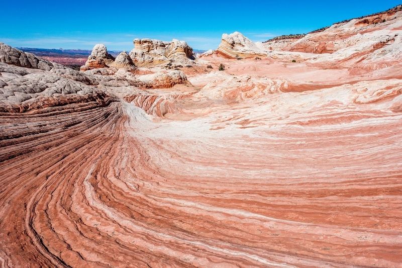
Few rock formations in the country have a fan club like The Wave. Its curving, striped sandstone is the reason so many hikers put this monument on their bucket lists.
Getting there is not as simple as showing up with a water bottle. To visit The Wave, you need a permit.
Permits are handed out through a lottery system, and luck plays a big role. Plenty of hopeful hikers try the daily lottery and walk away without a spot.
The good news is that a missed permit does not ruin the trip. Many hikers who strike out on The Wave head to other trails in the monument and still leave thrilled.
Some lucky winners score permits to Coyote Buttes South, another area in the monument with striking formations. Those who have gone describe it as absolutely worth the effort.
Hiring a local guide can also make the day easier, especially in remote areas where the routes are not always obvious. A guide can help with navigation and point out details you might miss.
So enter the lottery, cross your fingers, and keep a backup plan in your pocket. Arizona has plenty of sandstone to go around.
White Pocket’s Otherworldly Swirls
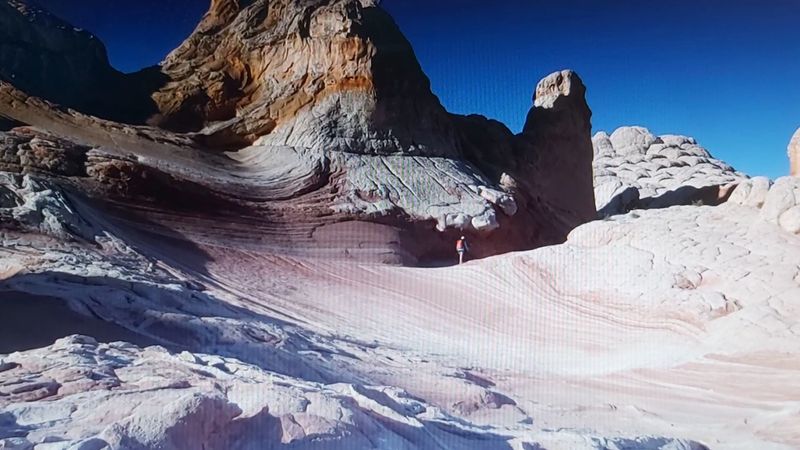
Ask backcountry explorers for a Wave alternative, and White Pocket often comes up first. It is known as one of the most unique land formations in the whole region.
The rock here swirls and folds in patterns that seem almost unreal. Many people who visit say it is unlike anything they have ever seen.
It is also one of those places that makes travelers want to come back. After a first visit, many leave wishing they had more time to explore the rest of the area.
Reaching White Pocket takes effort. The monument has a large, remote network of 4×4 trails that wander across the Vermilion Plateau.
Those trails can be sandy, and some stretches are long and plain before the good stuff appears. White Pocket is one of the rewards waiting at the end of those rough routes.
Cottonwood Cove is another interesting spot reached by these backcountry trails. Both locations show off the colorful sandstone that gives this monument its reputation.
Bring the right vehicle, plenty of patience, and a good map. The sandy miles make the payoff feel even sweeter.
Slot Canyon Squeezes at Wire Pass
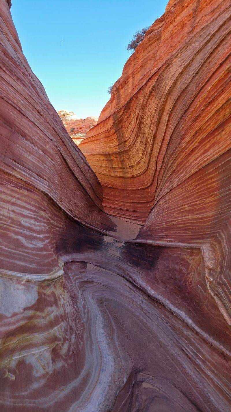
Some hikers boldly claim this canyon beats the famous Antelope Canyon. That is a big statement in a state full of slot canyons.
Wire Pass is a great slot canyon, and it is one of the most popular hikes in the monument. People who walk the trail say it is worth every step.
The canyon walls close in tight as you go. It is a fun trail for anyone who enjoys winding through narrow rock passages.
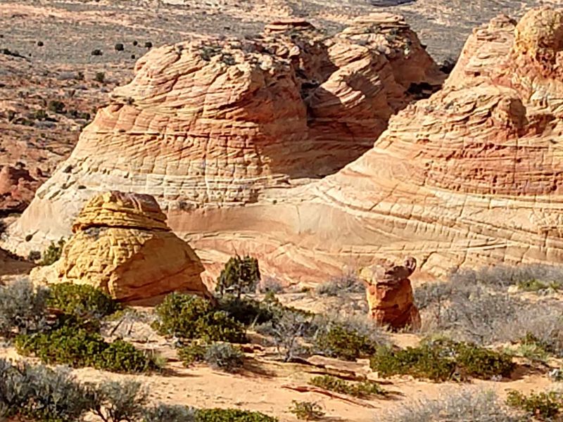
Here is a bonus tip that is easy to miss. If you wander just a little off the Wire Pass route, there is an area full of teepee-like rock shapes.
Those cone-shaped formations add another layer of variety to the hike. It is the kind of side trip that turns a good day into a memorable one.
Wire Pass also connects with Buckskin Gulch, another well-known canyon in the area. That makes it a handy starting point for hikers who want more time in the slots.
Wear sturdy shoes and check conditions before heading in. Slot canyons are amazing, but they deserve respect.
Buckskin Gulch Without the Crowds
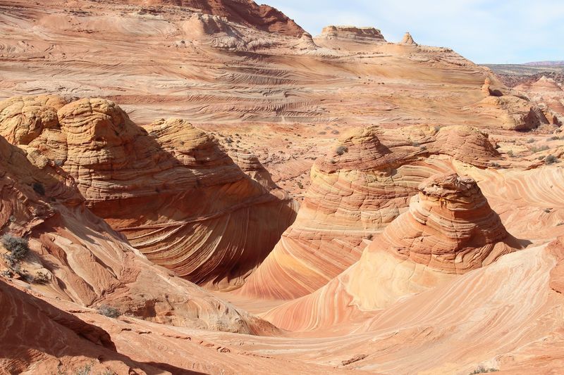
Missing out on a Wave permit has sent many hikers down a different path, straight into Buckskin Gulch. Plenty of them end up glad they did.
The hike is incredibly scenic. The trail runs between narrow canyon slots, with rock walls rising on both sides.
One of the best parts is the quiet. Hikes around this monument are not too crowded, so you often get large stretches of trail to yourself.
That is a real treat for Arizona hikers used to packed trailheads on weekends. Here, there is room to slow down and take in the canyon at your own pace.
Buckskin Gulch works well as a Plan B, but it holds up as a destination on its own. It shows off the same kind of carved sandstone that makes the region famous.
Go prepared with water, snacks, and a solid plan. Cell service can be spotty or missing in this area, so download maps and share your route with someone before you leave.
A missed lottery might sting for a moment. A day in Buckskin Gulch tends to fix that fast.
Condors Over the Cliffs
Keep one eye on the trail and the other on the sky. Condors are one of the popular talking points among people who visit these cliffs.
These large birds are a special sight in northern Arizona. Spotting one gliding near the red walls can become a highlight of the trip.
Wildlife here is a quiet part of the story. Small streams in some of the steep canyons provide enough moisture to support a sampling of animals.
That means the monument is more than bare rock. The mesas, buttes, and canyons form a home for creatures that have adapted to this rugged land.
Bring binoculars if you have them. A long lens on a camera can help too, since the birds often stay high above the ground.
Patience is the best tool for wildlife watching. Pull over at a safe spot, scan the cliff faces, and give it some time.
Remember to keep your distance from any animals you see. Watching quietly from afar protects both you and the wildlife that calls this place home.
A condor sighting will not be guaranteed on any given day, but the chance alone makes every glance upward worth it.
Route 89A, a Road Trip Favorite
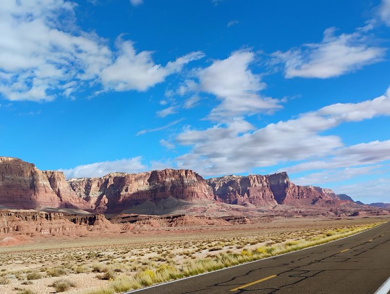
Not every great visit here requires hiking boots. For many travelers, simply driving past the cliffs is more than enough.
Route 89A delivers great views of the Vermilion Cliffs, with a few pull-off spots for pictures. The cliffs stretch on for miles along the road.
Motorcycle riders love this stretch too. The ride on 89A from Kanab to Route 89, then on toward Horseshoe Bend and Page, is called by some the best motorcycle ride they have taken.
The drive can feel long, but that is part of the appeal. It shows off the huge scale of the landscape in a way photos rarely capture.
This route also works as a scenic link between big destinations. It is a strong choice for anyone heading toward Zion, the Grand Canyon, Page, or Flagstaff.
Rainy days can add something extra. Clouds around the cliffs make the scenery look even more mysterious, and the walls stay impressive from the road.
The area is remote, with long stretches between stops. Fill your gas tank and pack water before setting out.
Sometimes the best parking spot is simply a pull-off with a view.
Lees Ferry, Navajo Bridge, and Cathedral Wash
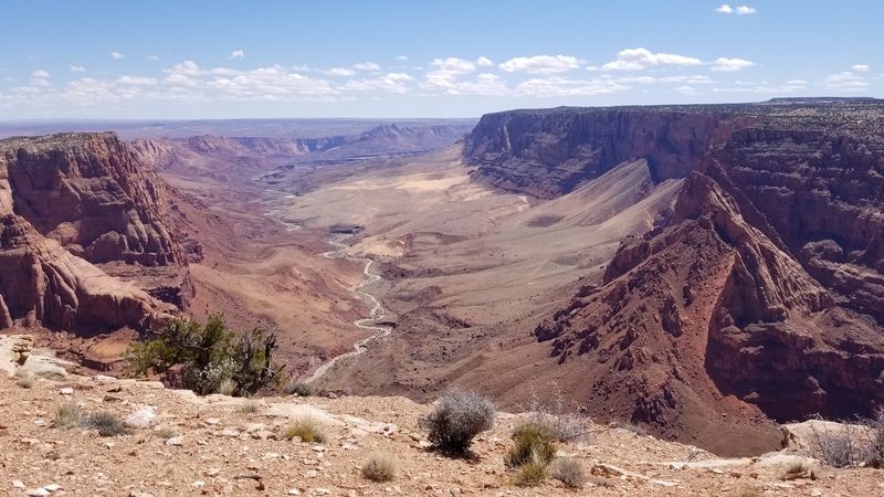
History lovers will find plenty to explore near the monument’s Marble Canyon side. The Lees Ferry, Marble Canyon, and Navajo Bridge area is known for its historic character.
Travelers often describe it as a place where little seems to have changed in the past 100 years. That timeless feel makes it a favorite stop on northern Arizona road trips.
Some people who go on to visit the North Rim of the Grand Canyon, Zion, and Bryce Canyon still say an overnight in Marble Canyon is what they remember most.
Marble Canyon itself is a beautiful drive. The area pairs well with a slower trip through the monument.
Hikers have another option nearby, the Cathedral Wash hike by Lees Ferry. Just know what you are getting into before you start.
On Cathedral Wash, you do almost as much climbing as you do walking. It is a fun challenge, but it is not a lazy stroll.
Wear shoes with good grip and leave extra time. Your legs will thank you later, even if they complain along the way.
What to Know Before You Go
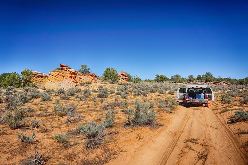
A little homework goes a long way out here. The monument is open 24 hours a day, seven days a week, but reaching its best spots takes planning.
Many interior areas require four-wheel drive. Roads can be very rocky, and one rough route can take about an hour to reach the more interesting sections.
Sand is another big factor. The large, remote network of 4×4 trails on the Vermilion Plateau includes plenty of sandy stretches.
Even the backcountry trails do not always get you right to the cliffs. Many end about half a mile from the cliff, so plan on a short hike to finish the trip.
Cell service is limited or missing in parts of the area. Download offline maps and directions before you lose signal.
Camping is dispersed, which means there are no crowded campgrounds packed side by side. Sites tend to be spread far enough apart that you should be left alone to enjoy the quiet.
For current conditions and permit details, check the Bureau of Land Management website for Vermilion Cliffs. Being prepared is the difference between a frustrating detour and a fantastic day.
Arizona’s Answer to Utah Red Rock
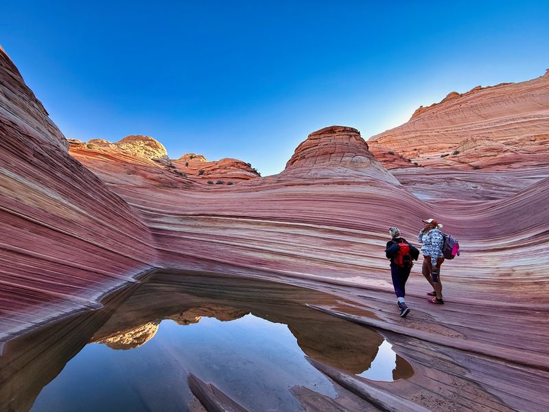
Utah may get the headlines, but Arizona locals have a strong case right here. Some travelers rank this monument in the top two areas in the entire state.
It covers a lot of ground. There are roadside views for casual drivers, slot canyons for hikers, and backcountry formations for anyone with a sturdy vehicle.
The landscape can feel almost foreign. Many say words and photos cannot do it justice, and it can seem like a different planet.
Beyond the scenery, the land holds deep human history. People lived here long ago, and some communities are still connected to the land today, which earns this place a lot of respect.
It is not for everyone who expects a paved path to every sight. The area is remote, the roads can be rough, and the famous spots take effort.
For those willing to plan ahead, though, the rewards are huge. The cliffs, canyons, and swirling sandstone give Arizona a red rock showcase that stands tall next to anything across the state line.
So the next time someone brags about Utah, just smile and point north on 89A.