Affiliate disclosure: As an Amazon Associate I earn from qualifying purchases. Learn more
Arizona has a way of hiding its best stuff in plain sight. Everybody knows about the Grand Canyon and the red rocks of Sedona, but there is a whole layer of the state that even people who have lived here for decades tend to breeze right past.
Slot canyons you can hike without a permit, a full-size London bridge sitting in the desert, waterfalls in the middle of Phoenix, and towns that feel frozen in another century. These are the kinds of places that make you feel like a tourist in your own state, in the best possible way.
Here are 13 spots across Arizona that deserve a lot more attention than they get.
1. The Wave, Coyote Buttes North, near Page
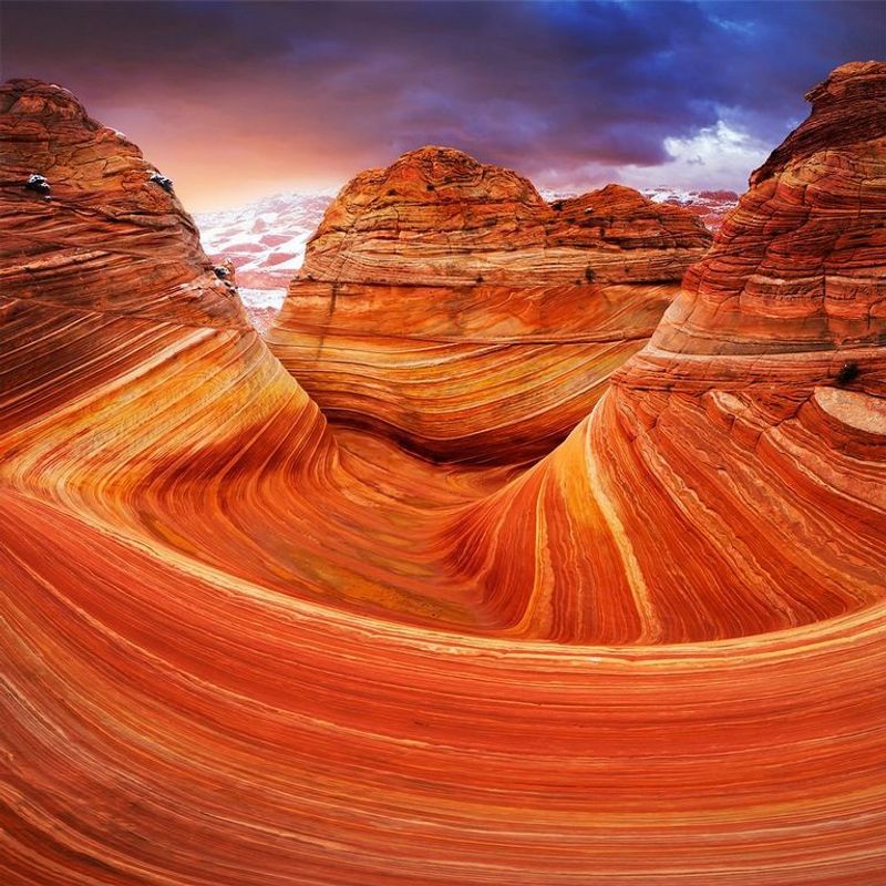
Swirling waves of red and orange sandstone make The Wave one of the most photographed rock formations in the country, and yet a lot of Arizonans have never set foot near it.
The reason is the permit system. Access is limited through a daily lottery run by the Bureau of Land Management, and only a small number of people are allowed in each day to protect the fragile stone.
That scarcity is exactly why it stays quiet.
The hike sits in the Vermilion Cliffs area near the Arizona and Utah border, and the round trip runs roughly six miles with no marked trail. You navigate by landmarks and the map the BLM provides.
Bring far more water than you think you need, since there is no shade and no services once you leave the trailhead. If you win a permit, treat it like the rare ticket it is.
2. Havasu Falls, Havasupai Reservation, near Supai
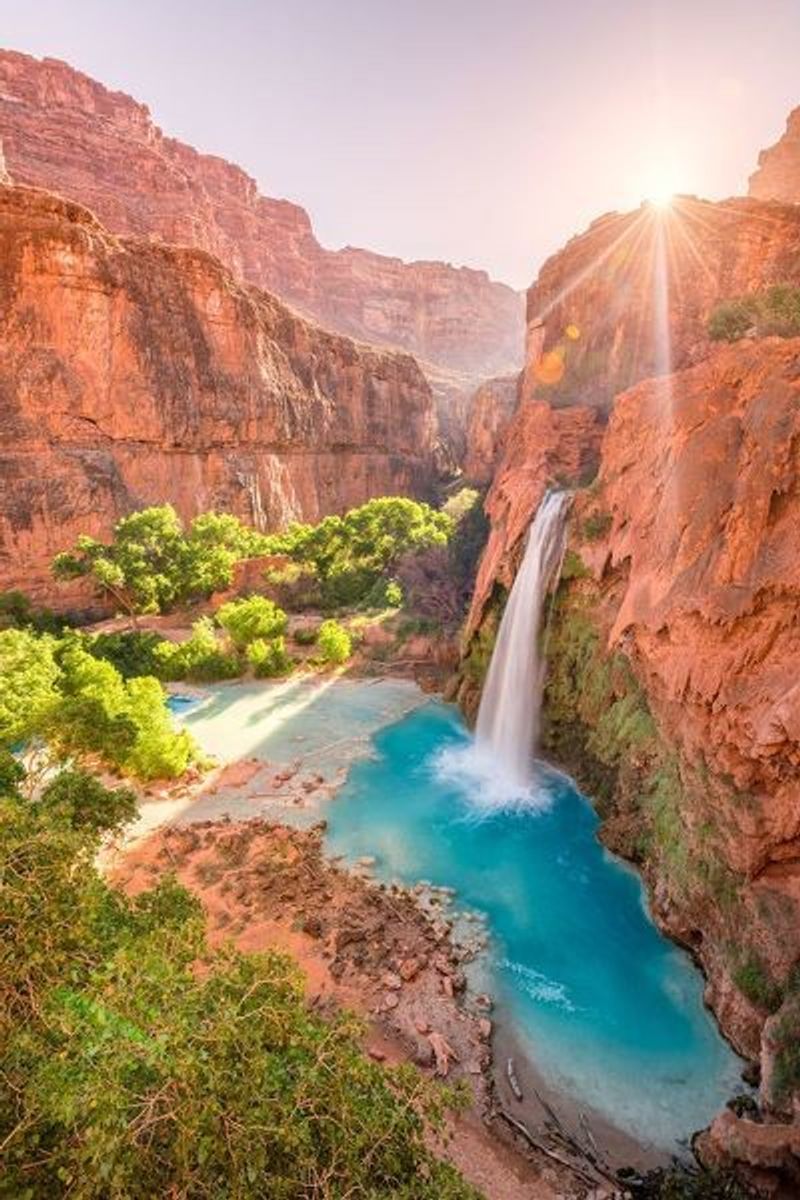
Turquoise water pouring over red rock walls sounds like something from a tropical postcard, but Havasu Falls sits deep in a side canyon of the Grand Canyon, on Havasupai tribal land.
Getting there takes commitment. Reaching the falls means a roughly ten-mile hike each way to the village of Supai and the campground beyond, and permits from the Havasupai Tribe are required well in advance.
The blue-green color comes from high mineral content in the creek, which is why the water looks almost unreal in photos. Havasu is the most famous of several waterfalls along the same route.
Day trips are not allowed, so plan on camping or staying at the lodge. Because access is controlled by the tribe, this stays one of the least crowded famous waterfalls you will find anywhere in the Southwest.
3. London Bridge, Lake Havasu City
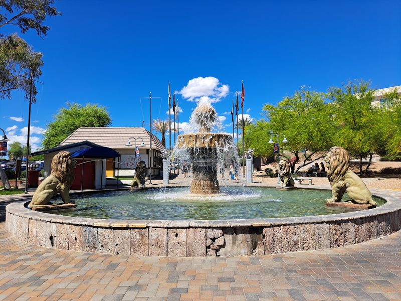
Yes, the actual London Bridge, the one from England, sits in the Arizona desert spanning a channel of the Colorado River.
The story is genuinely strange. In the late 1960s, the old bridge over the River Thames was being replaced, and the founder of Lake Havasu City bought it, had it dismantled stone by stone, shipped it across the ocean, and reassembled it here.
It reopened in the early 1970s.
Today the bridge anchors an English Village shopping and dining area, and you can walk across it for free any time. Boats pass underneath in the water below.
It remains one of the more surprising pieces of history in the state, and a great excuse to combine a lake day with a little bit of imported London. Few visitors expect a genuine antique bridge in this stretch of the desert.
4. Antelope Canyon, near Page
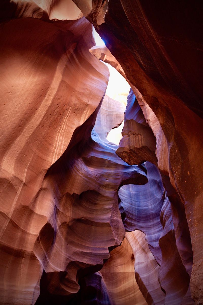
Beams of light cutting through narrow sandstone corridors have made Antelope Canyon a bucket-list stop, but plenty of Arizonans still have not made the trip up north to see it.
The canyon sits on Navajo Nation land near Page and is split into Upper and Lower sections. Access is only allowed with an authorized Navajo guide, which keeps foot traffic managed and adds real context to the visit.
Upper Antelope Canyon is known for the light beams that appear during certain midday hours in the warmer months. Lower Antelope Canyon involves stairs and tighter passages, which some people find more adventurous.
Book tours ahead of time, especially in peak season, because spots fill fast. The smooth, flowing shapes of the walls were carved over ages by flash floods and wind, and photos rarely do the scale justice.
5. Bisbee, Cochise County
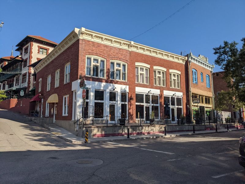
An old copper mining town clinging to steep hillsides, Bisbee traded pickaxes for paintbrushes decades ago and became one of Arizona’s most character-filled small towns.
Colorful buildings stack up the canyon walls, connected by staircases that climb between streets. The historic district is packed with galleries, shops, cafes, and the kind of quirky storefronts you want to wander into without a plan.
History runs deep here. The Copper Queen Mine offers underground tours where you ride into the old workings on a small train, and the Bisbee Mining and Historical Museum fills in the rest of the story.
Located in the far south of the state near the border, Bisbee sits at a higher elevation than the desert floor, so it stays cooler than Phoenix in summer. It is a perfect weekend escape for anyone who likes their small towns full of art and a little bit weird.
6. Chiricahua National Monument, near Willcox
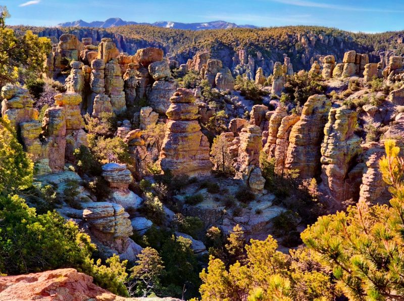
Thousands of towering rock spires standing in clusters gave Chiricahua the nickname Wonderland of Rocks, and it may be the most overlooked national monument in Arizona.
The formations are balanced rock columns and pinnacles carved from ancient volcanic material. Hiking trails wind right through them, letting you walk among stone towers that seem to defy gravity.
The Echo Canyon Loop is a popular route that threads between the rocks, and the scenic drive up to Massai Point delivers wide views without much effort. The monument sits in the southeastern corner of the state near Willcox.
Because it is far from the big cities and interstate corridors, crowds stay light even during good weather. The elevation also keeps temperatures more comfortable than the low desert.
For anyone who loves strange geology and quiet trails, this is a rewarding drive.
7. Tonto Natural Bridge State Park, near Payson
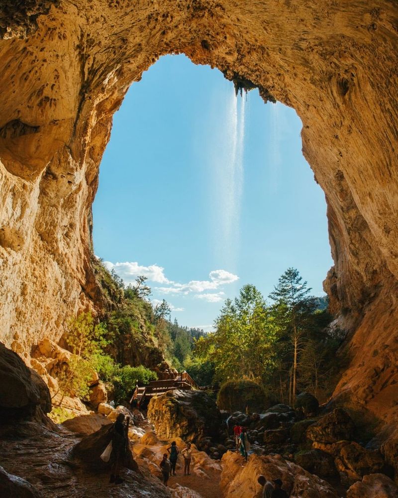
Believed to be one of the largest natural travertine bridges in the world, this massive arch sits tucked into a green canyon just off the highway near Payson.
The bridge stands well over a hundred feet high and spans a tunnel that a creek runs through. Several trails lead down into the canyon, and the Waterfall Trail brings you to a spot where water drips over the rock into a shaded grotto.
Some paths are short and easy, while the descent to the bottom is steeper and rockier, so wear shoes with good grip. The state park charges a modest entrance fee.
Set in the cooler high country of central Arizona, the park makes a great summer stop when the desert below is baking. Many people driving toward Payson have passed the turnoff for years without realizing what is down there.
8. Kartchner Caverns State Park, near Benson
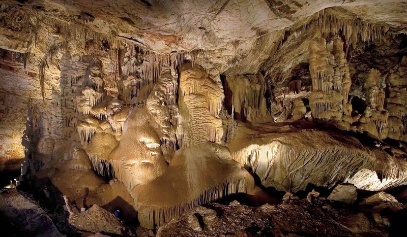
A living limestone cave system hidden beneath the desert floor stayed a secret for years while it was carefully protected before opening to the public.
Kartchner is a wet cave, meaning its formations are still growing as water drips through the rock. Guided tours lead you past stalactites, stalagmites, and one of the tallest soda straw formations recorded, with staff working hard to keep the delicate environment intact.
The caverns sit near Benson in southern Arizona, and tour tickets are often reserved in advance because group sizes are limited. Photography inside is restricted to protect the cave.
Above ground, the state park has a visitor center, hiking trails, and picnic areas. Since the temperature underground stays cool and steady year round, it makes an easy escape from the heat any month of the year.
9. Jerome, Yavapai County
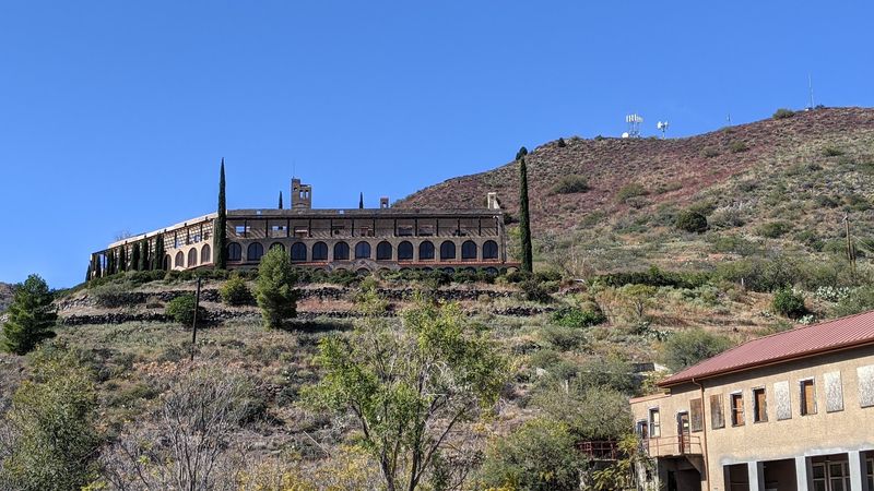
Perched on the side of Cleopatra Hill, Jerome once boomed as a copper mining town and later nearly emptied out before artists and shopkeepers gave it a second life.
The town sits high above the Verde Valley, so the views stretch for miles across the landscape below. Winding streets lead past galleries, boutiques, and the Jerome State Historic Park at the old Douglas Mansion, which tells the mining story.
Its dramatic setting on a steep slope is part of the appeal, with buildings stacked up the hillside and switchback roads connecting them. The elevation keeps it noticeably cooler than the valley.
Jerome also carries a reputation as a place full of history and ghost stories, which draws curious visitors year round. It pairs well with nearby Sedona for a longer day trip through the high country.
10. Salt River Wild Horses, Tonto National Forest
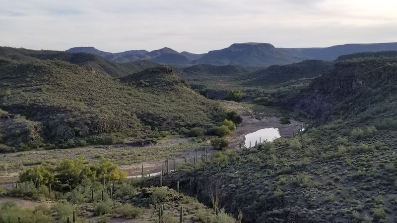
Wild horses wading through a desert river within reach of metro Phoenix sounds unlikely, yet the Salt River herd is very real and can often be spotted grazing along the banks.
The horses roam the lower Salt River in the Tonto National Forest, east of the city near Mesa. They are protected, and there are strict rules about keeping your distance and never feeding them.
Good places to look include recreation sites along the river such as Coon Bluff and Phon D Sutton, especially in the early morning or evening when the animals move to drink. Sightings are never guaranteed, which is part of the thrill.
A Tonto Pass is required to park at many of the recreation areas. Combine a horse-watching trip with tubing or a picnic by the water for one of the most surprising outings this close to the city.
11. Roosevelt Point and Cape Royal, North Rim, Grand Canyon
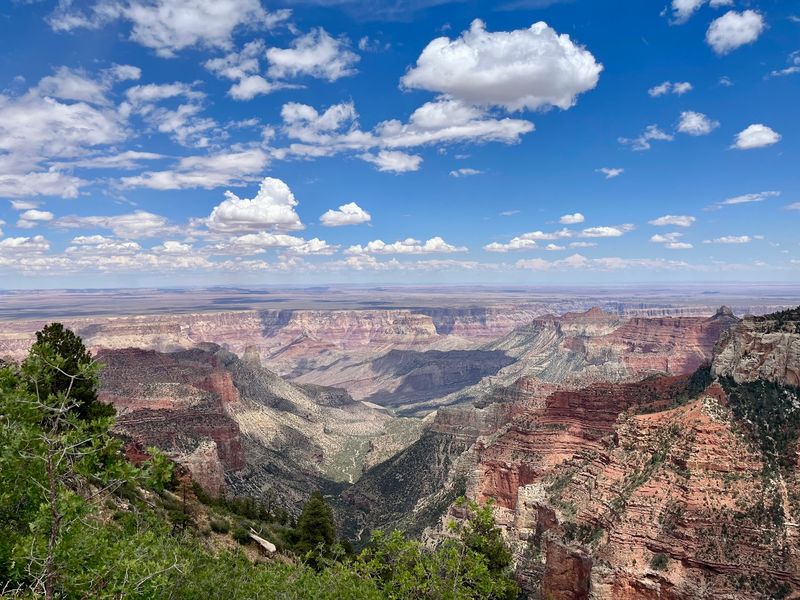
Everyone flocks to the South Rim, which is exactly why the North Rim of the Grand Canyon feels like a different, quieter world.
Sitting at a higher elevation, the North Rim is covered in forests of pine and aspen and stays much cooler. It is only open seasonally, generally from mid-May into the fall, because heavy snow closes the road in winter.
Cape Royal offers sweeping views and a short paved path to overlooks, while nearby Roosevelt Point gives you another dramatic vantage with far fewer people around. The drive out along the scenic road is a highlight on its own.
Lodging and services are limited here, so plan ahead and check seasonal opening dates before you go. For anyone who thinks they have already seen the Grand Canyon, the North Rim proves there is a whole other side to it.
12. Tumacacori National Historical Park, near Tubac
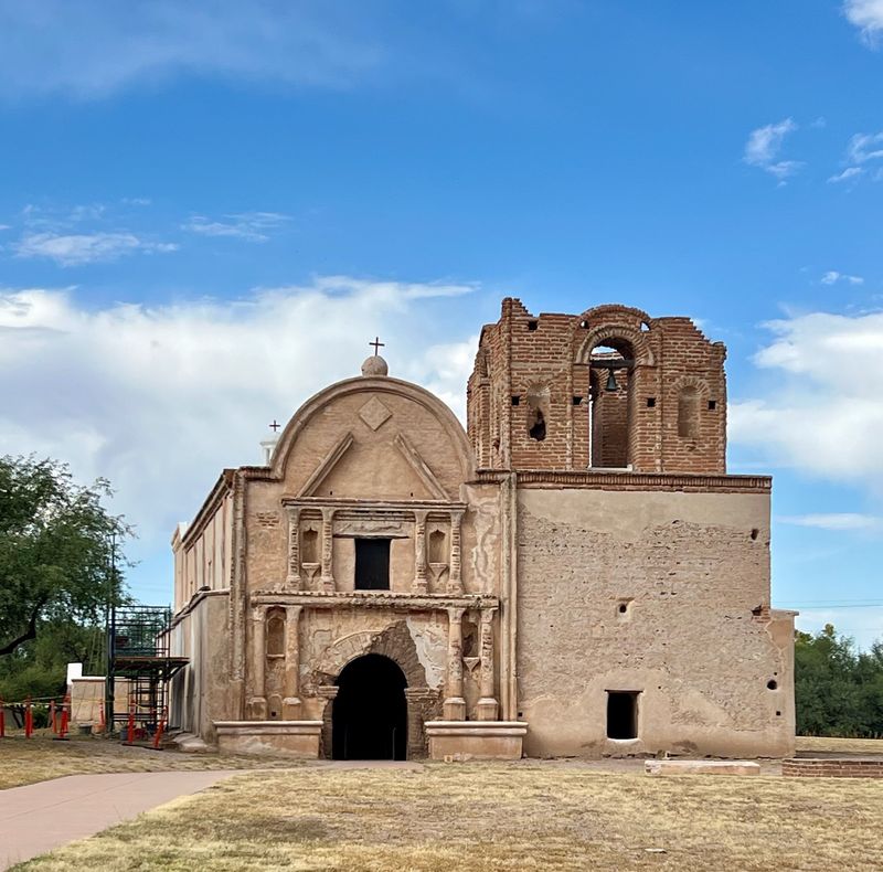
Weathered adobe walls of an old Spanish mission church rise from the Santa Cruz Valley at Tumacacori, a quiet corner of history most Phoenix and Tucson residents drive right past on the way south.
The park preserves the ruins of a mission founded in the late 1600s, including a large church, a cemetery, and remains of the surrounding community. Interpretive exhibits and a museum explain the layered story of the Native peoples and Spanish missionaries connected to the site.
The grounds are peaceful and walkable, with an entrance fee that covers the visitor center and the historic buildings. Special cultural events and craft demonstrations happen throughout the year.
It sits close to the artist colony of Tubac, so you can pair a visit with shopping and lunch. For a slower, history-rich stop in southern Arizona, this one delivers real depth.
13. Fossil Creek, near Strawberry
A spring-fed creek that runs a striking blue-green through the high desert, Fossil Creek is one of Arizona’s few designated Wild and Scenic Rivers and a beloved summer swimming destination.
The water gets its color from travertine minerals, and the creek stays cool and clear as it flows past small pools and cascades. Popular spots include the waterfall area and swimming holes reachable by trail.
Because it became so popular, access is now managed with a permit system during the busy warm-season months, so you need to reserve a parking permit ahead of time. The roads in can be rough, so check conditions before heading out.
Located between Strawberry and Camp Verde in central Arizona, it sits at an elevation that keeps things pleasant when the low desert is scorching. Go early, bring water and sun protection, and pack out everything you bring in.